Introduction to the design concepts
The design of Ontario Place’s public realm is an iterative process, and the design team has been working to address feedback received to date from the public, stakeholders and Indigenous communities. Public feedback received during this public engagement event and virtual public engagement room will be considered as the design work advances through to Spring 2023.
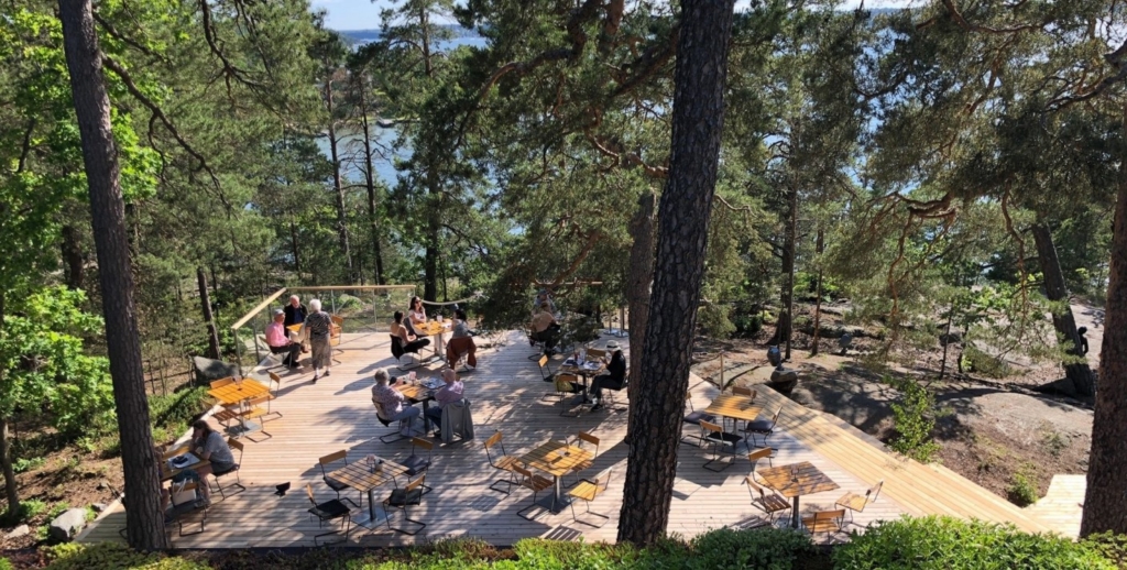
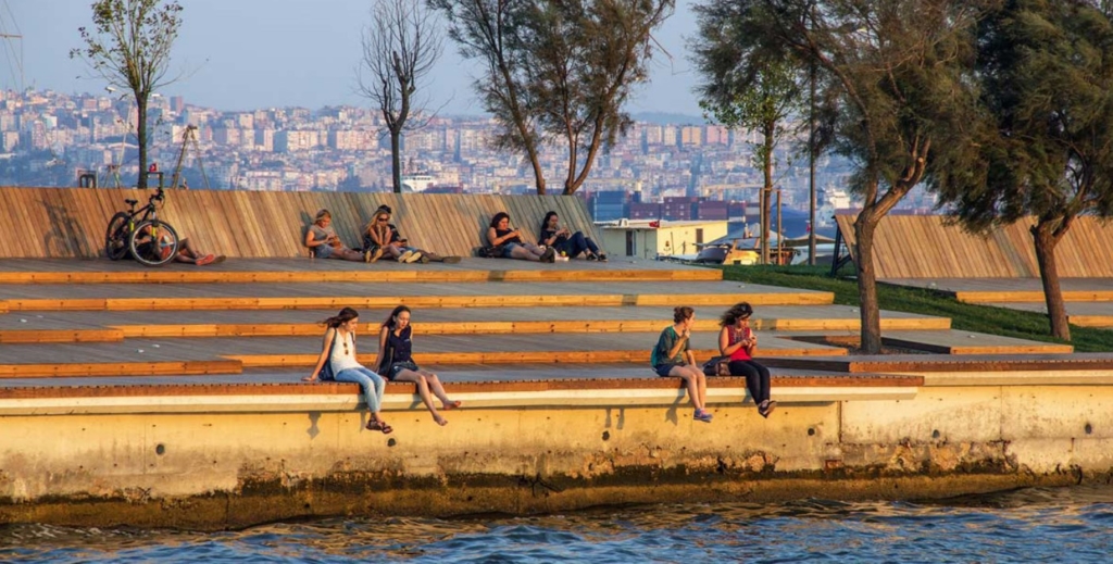
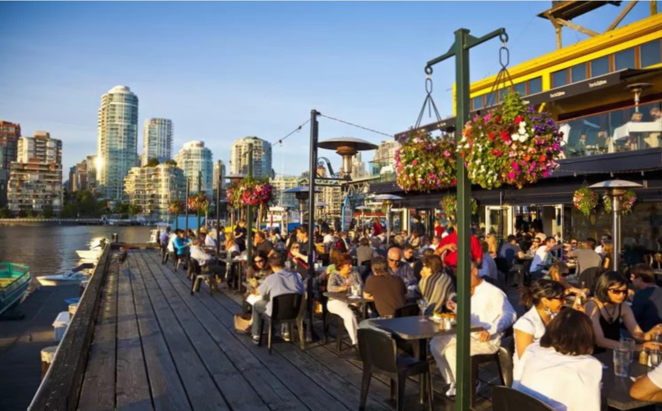
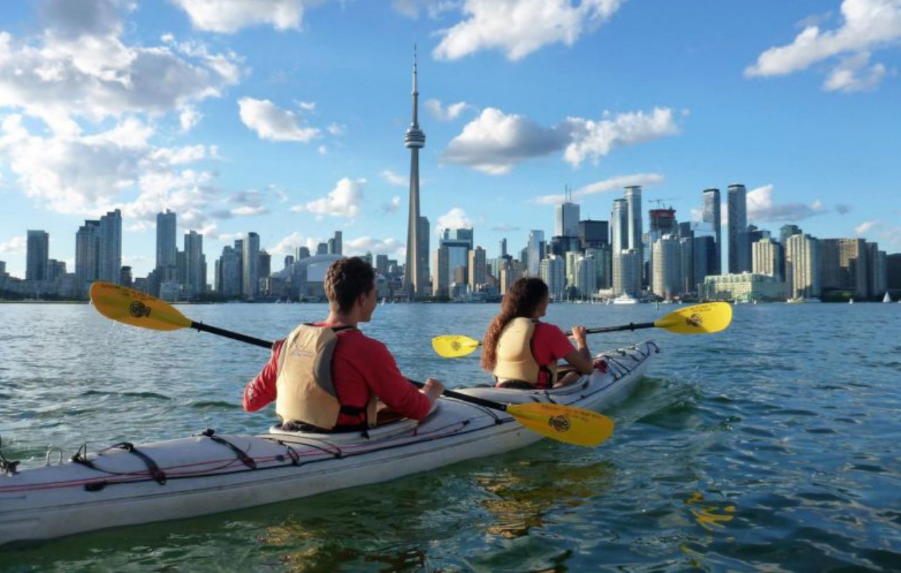
Since Spring 2022, the design team has created several design concepts that show how feedback from the public, Indigenous communities and stakeholders could be represented across the site. This Virtual Public Engagement Room will explore these conceptual designs with you. As Ontario Place is such a large site, to help you navigate this process, the Virtual Public Engagement Room has been split into five different zones. Within each zone the design team has created different design concepts for you to comment on. The conceptual design drawings are supplemented with precedent images from other parks that help illustrate how designs could be realized at Ontario Place.
The design concepts under consideration are not only helping to create beautiful spaces but will also resolve key issues impacting the site. These issues are presented for each zone and should be considered when you are providing feedback on which design aspects you think are most appropriate. Your feedback for each concept will help refine the thinking and design of the public realm.
The design concepts shown are conceptual and are not final. These are intended only to inspire an opportunity for comment and feedback. Public feedback received during this public engagement event and virtual public engagement room will be considered as the design work advances through to Spring 2023. Feedback will also be used to update the criteria that each option will be evaluated against by the Environmental Assessment (EA) team. In Spring 2023, preferred concepts for each of the five zones will then be brought together as an overall site plan for final review, comment, and refinement.
Understanding design concepts
- The Ontario Place Design team has participated in all consultation events to date. Their job is to distill your many ideas into a variety of design concepts for further consideration and assessment.
- Today’s design concepts are being used to test how the input we received from you in April might be realized on site in the future.
- These design concepts are being used to show you a range of potential uses and design features.
- Based on feedback from today, the design team and the EA team will work together to assess the different design concepts to identify what features should be considered further as the design work evolves.
The design assessment is a mandatory component of the Class EA process and all, part or none of the conceptual design plans for each zone may be carried forward following assessment. Feedback will also be used to update the criteria that each concept will be evaluated against by the EA team.
The Zones
The five zones are the key spaces that define the character of Ontario Place and are captured by the current EA process:
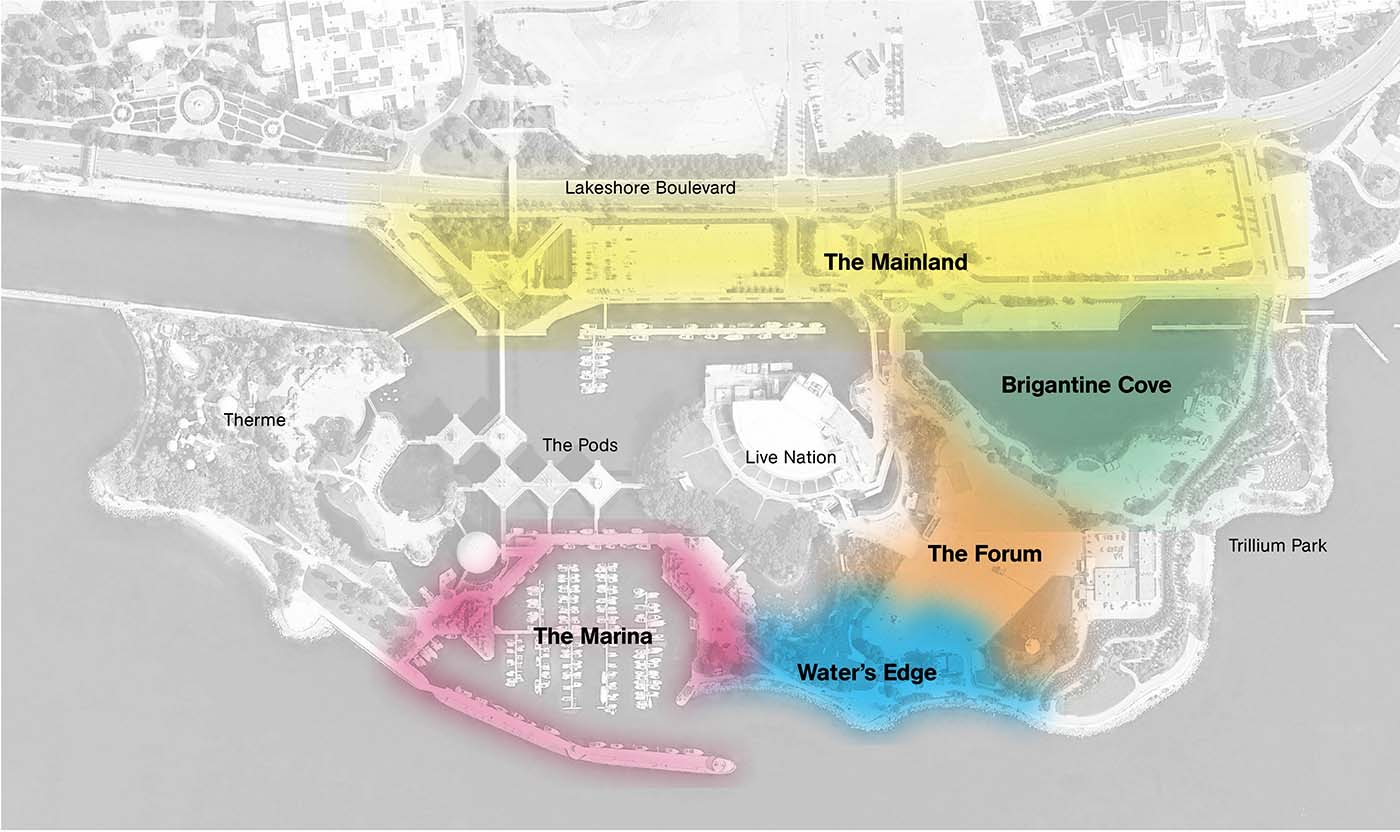
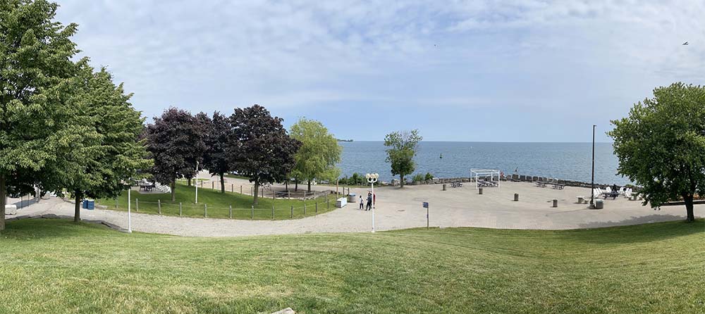
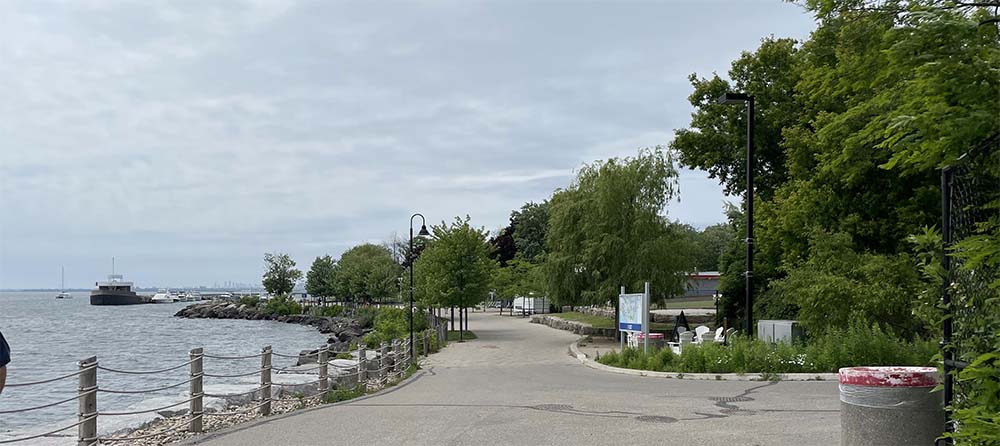
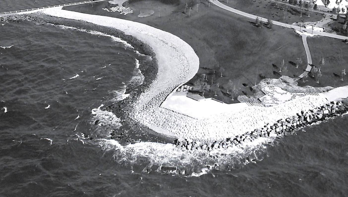
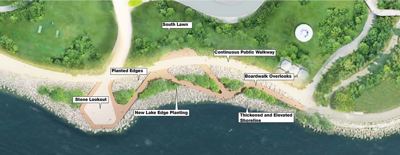
Zone 1: Water’s Edge
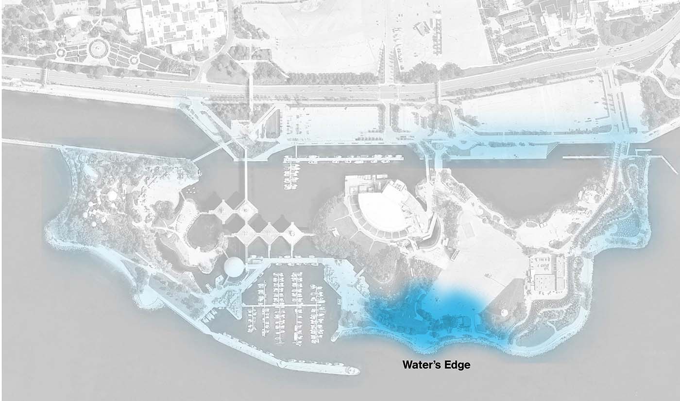
Design considerations
Issues
- Aging infrastructure.
- Flooding.
- Inaccessible shoreline.
Opportunities
- Update infrastructure.
- Create water access and maintain views to the water.
- Improve public spaces
- Maximize flood and storm protection.
- Create an ecologically sensitive shoreline.
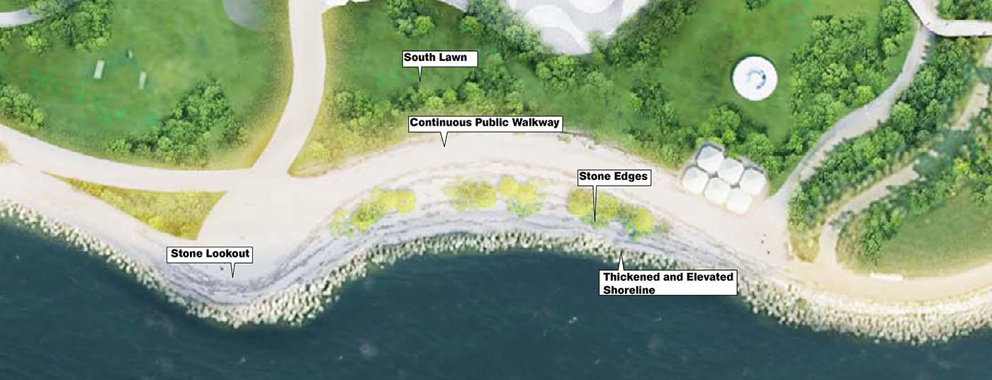
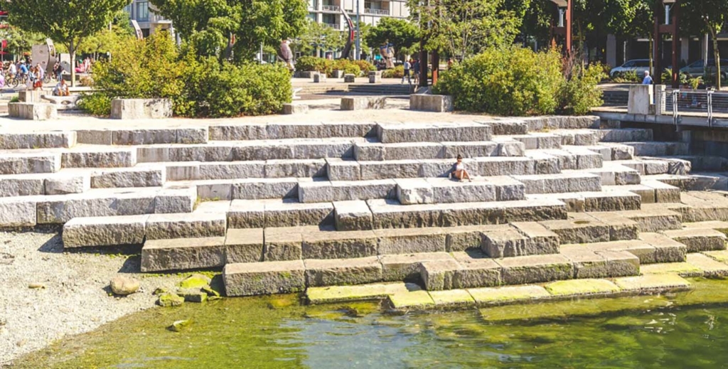
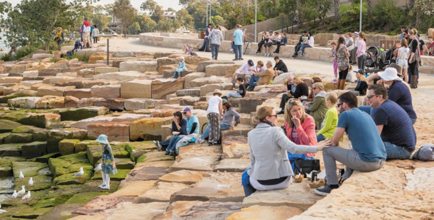
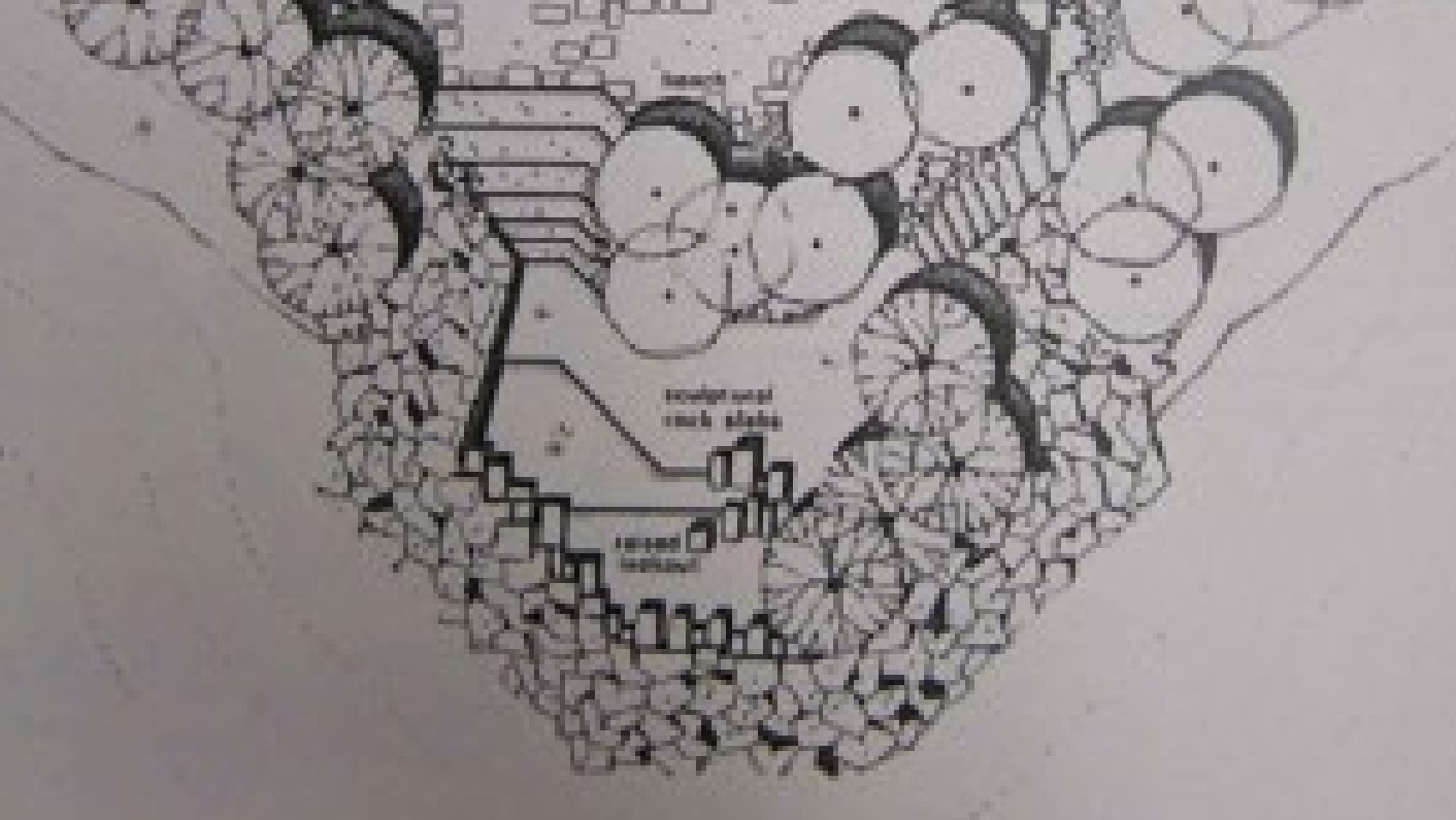
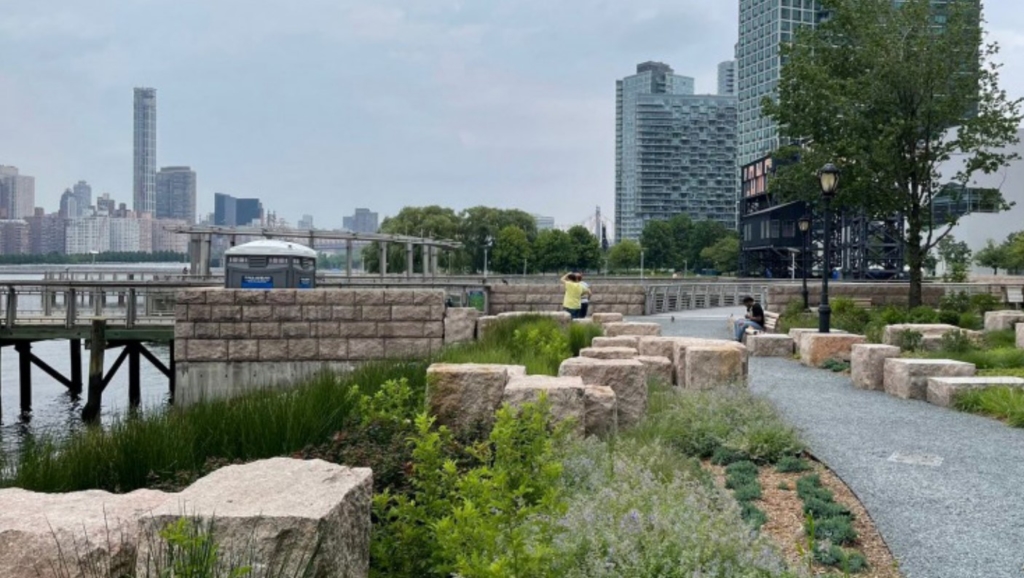
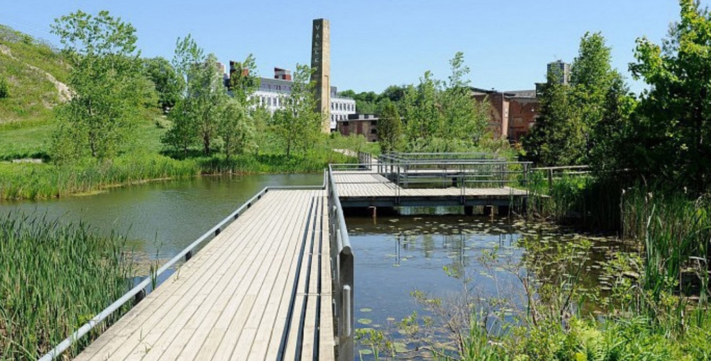
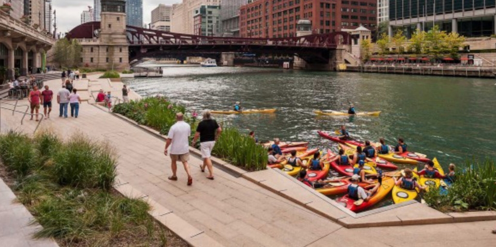
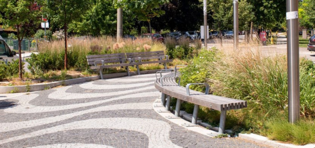
Concept A: Stone Lookouts
- Widened shoreline edge.
- Using shoreline protection to physically expand public realm.
- Accessible during all seasons.
- Raised elevation for flood protection.
- Lookouts and access to water for swimming and other recreational uses.
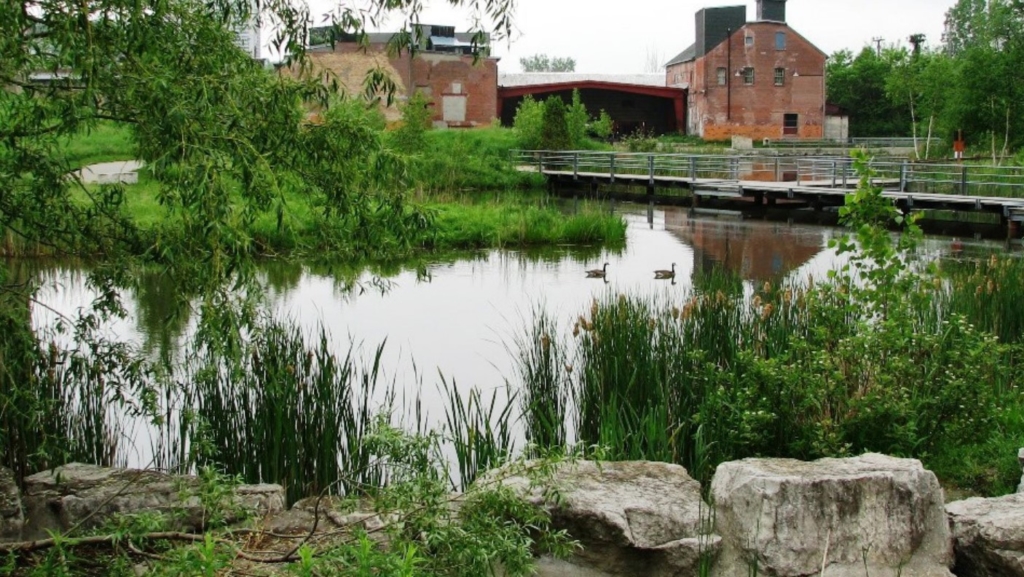
Concept B: Planted piers
- Planted, greener edge condition.
- Less access to water for users than Concept A.
- Raised shoreline for flood protection.
- Stormwater management.
- Lookouts and access to water for swimming and other recreational uses.

Feedback/comments
This section is now closed.
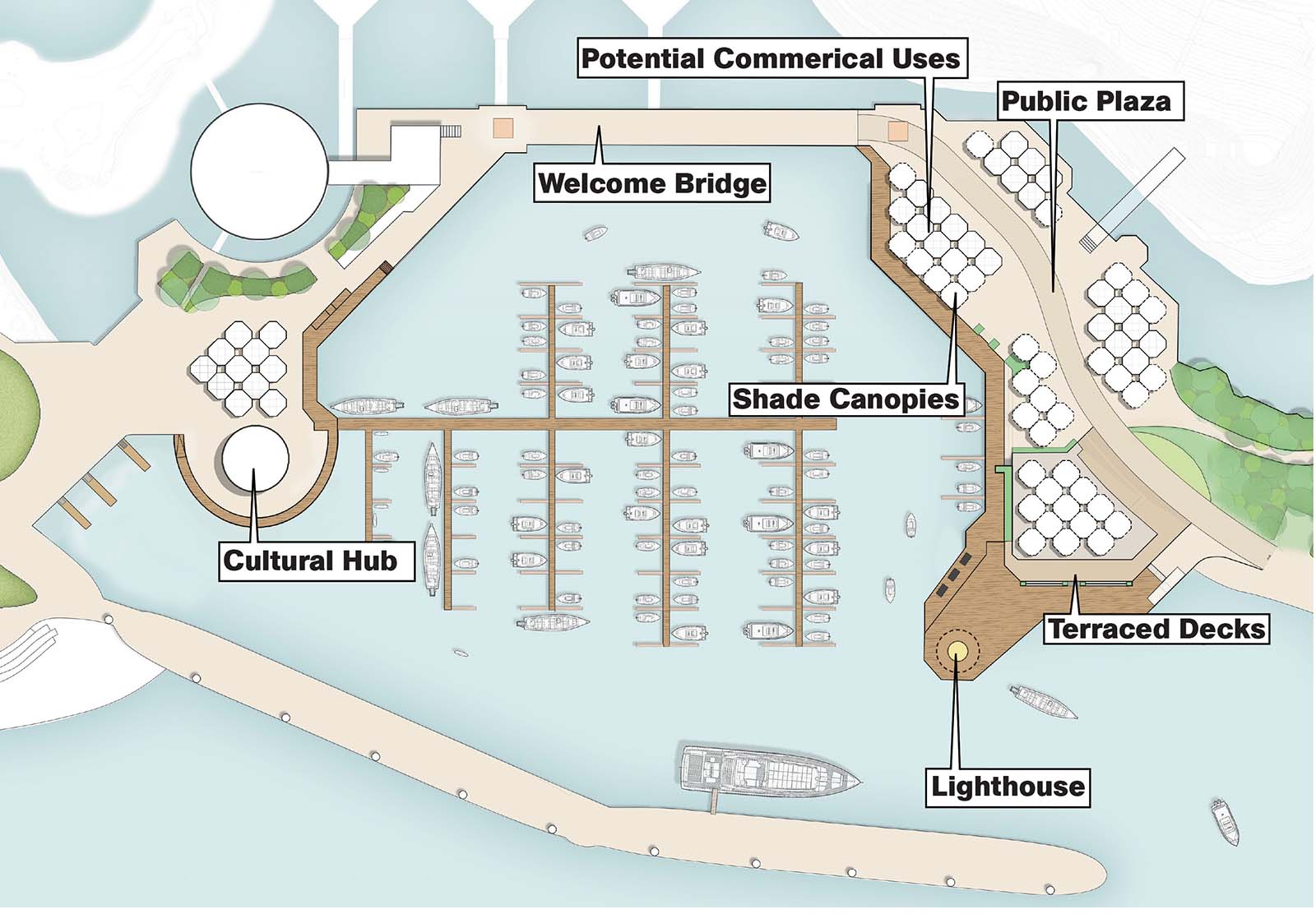
Zone 2: The marina
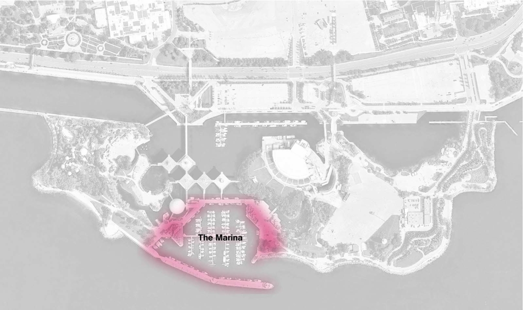
Design considerations
Issues
- Flooding.
- Stagnant water and poor circulation.
- Vacant buildings in poor condition.
- Deteriorated public realm.
- Lack of amenities and commercial activity.
- Lack of shaded areas and places for public seating.
Opportunities
- Improve water quality.
- Diversify boating slips / users.
- Preserve heritage structures.
- Generate commercial opportunities and increase activity.
- May be subject to modifications in future.
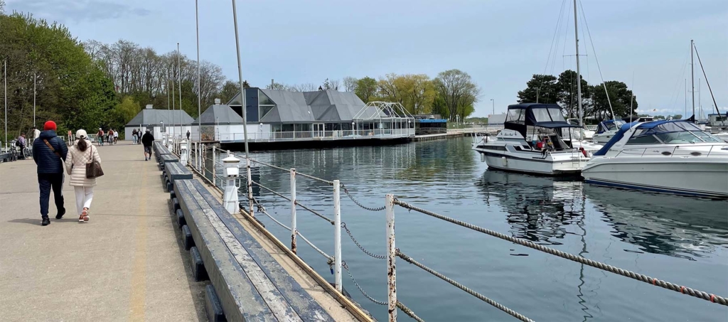
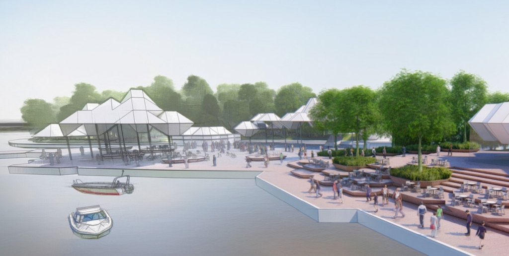
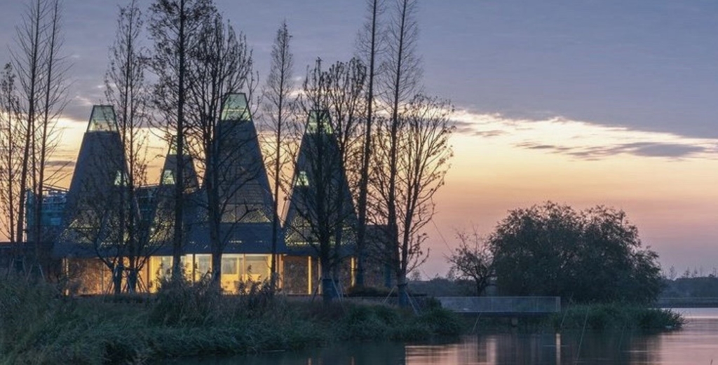
Concept A: Park Marina
- Recreate marina buildings as open-air park canopies for picnics, barbeque and shade along the waterfront.
- Rebuild existing buildings, as necessary.
- Create a greener marina with more shade.
- Focus on maximizing public space.
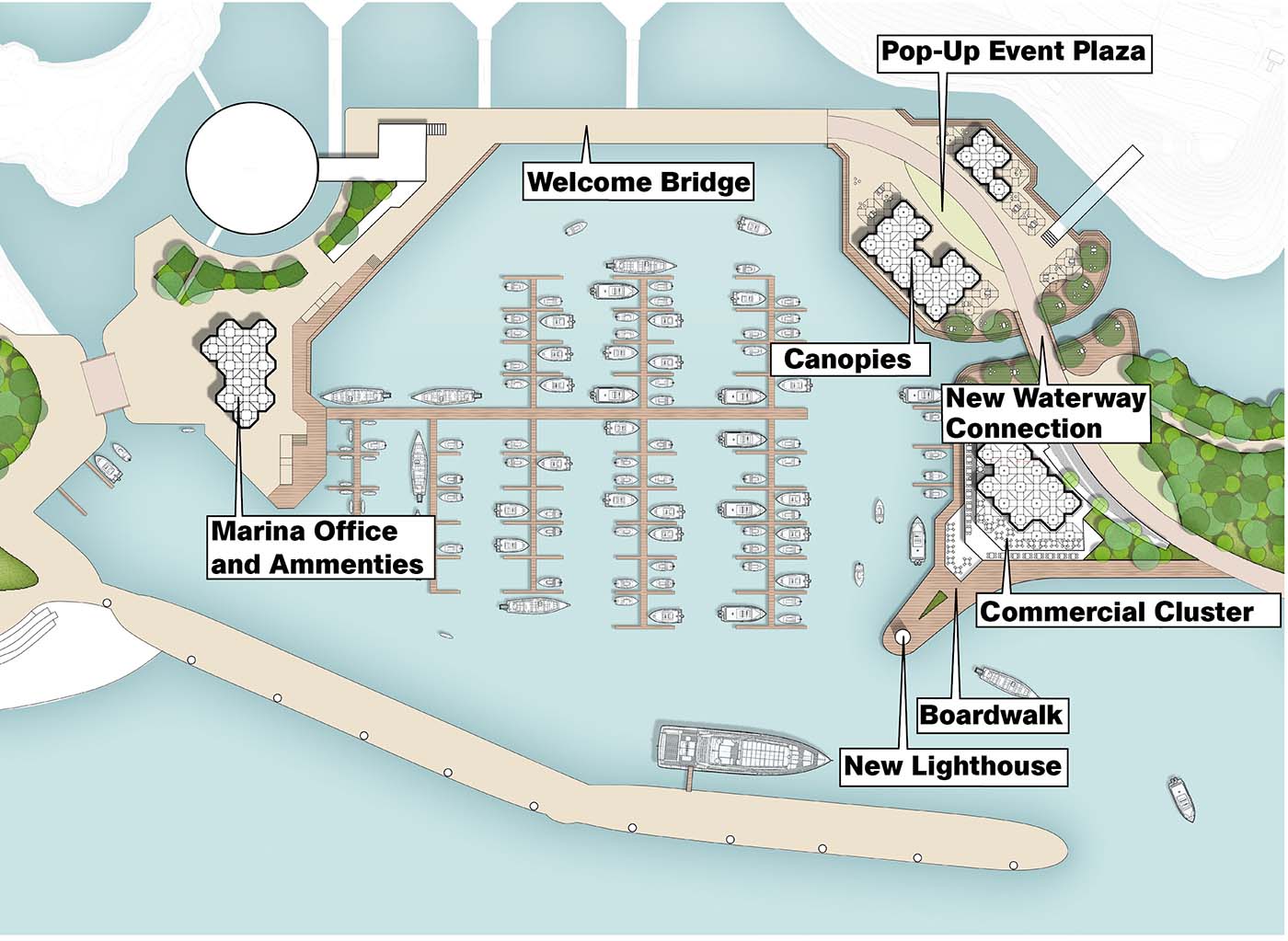
Concept B: Ontario Port
- Cultural hub for various place making opportunities
- Diversify or expand boat slips
- Vibrant commercial activity
- Wood boardwalk along both side of the marina for water’s edge experience
Feedback/comments
This section is now closed.
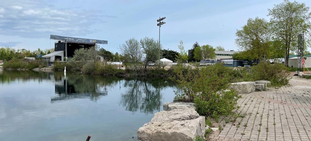
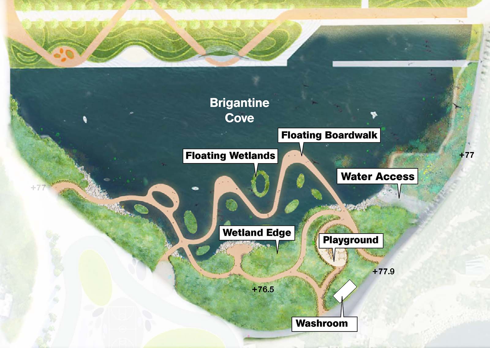
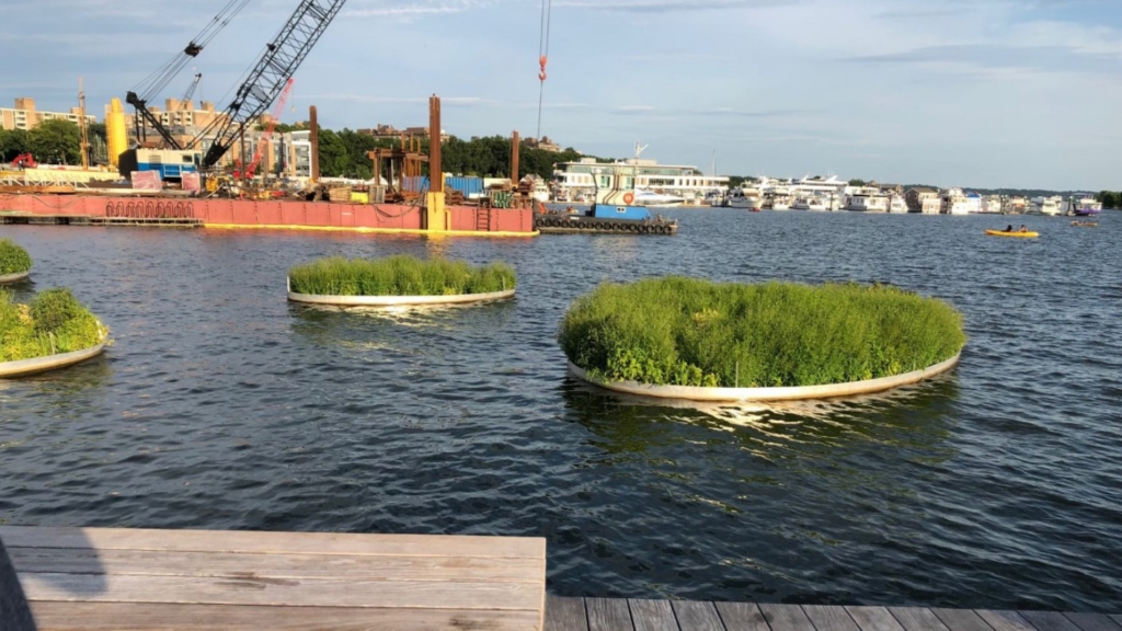
Zone 3: Brigantine Cove
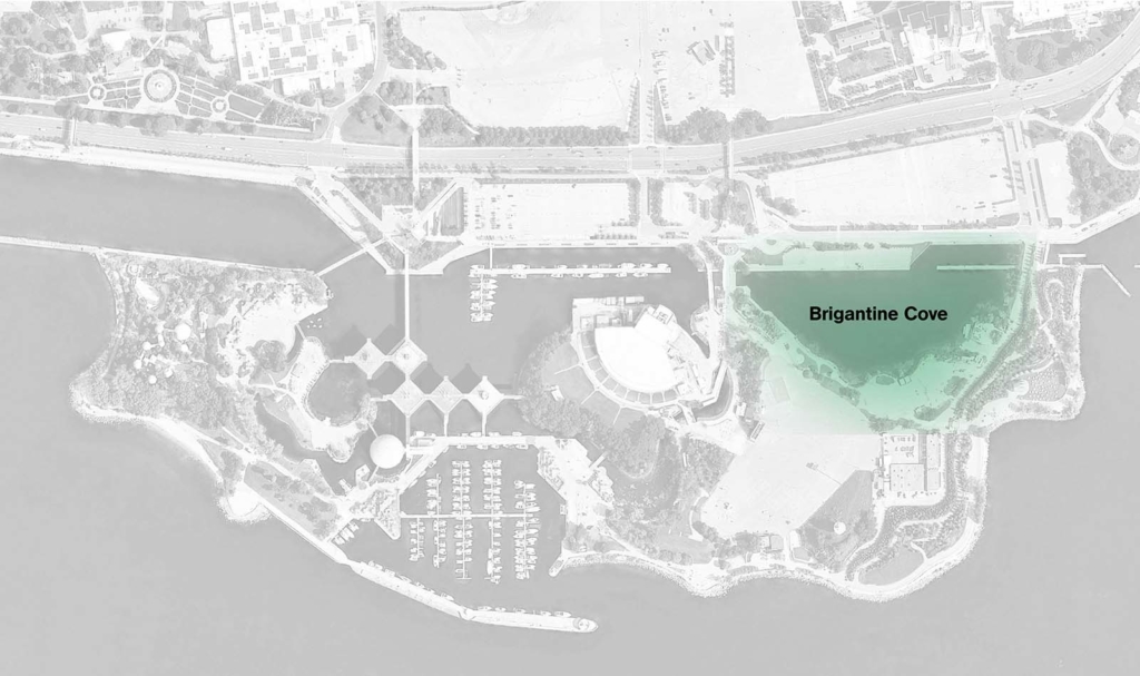
Design considerations
Issues
- Poor water circulation.
- Edged by parking and paving.
- Flooding.
- Very limited access to water.
Opportunities
- Water access.
- Increased tree canopy.
- New water’s edge.
- May be subject to modifications in the future.
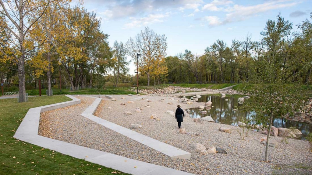
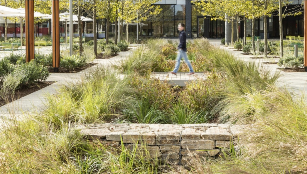
Concept A: Event + Activities
- Reinstates original Hough edge boundary.
- Large lawn becomes a place for events and activities.
- Landscaping and trees used to mitigate weather.
- Land-based boardwalk edge.
- Improved water circulation and quality.
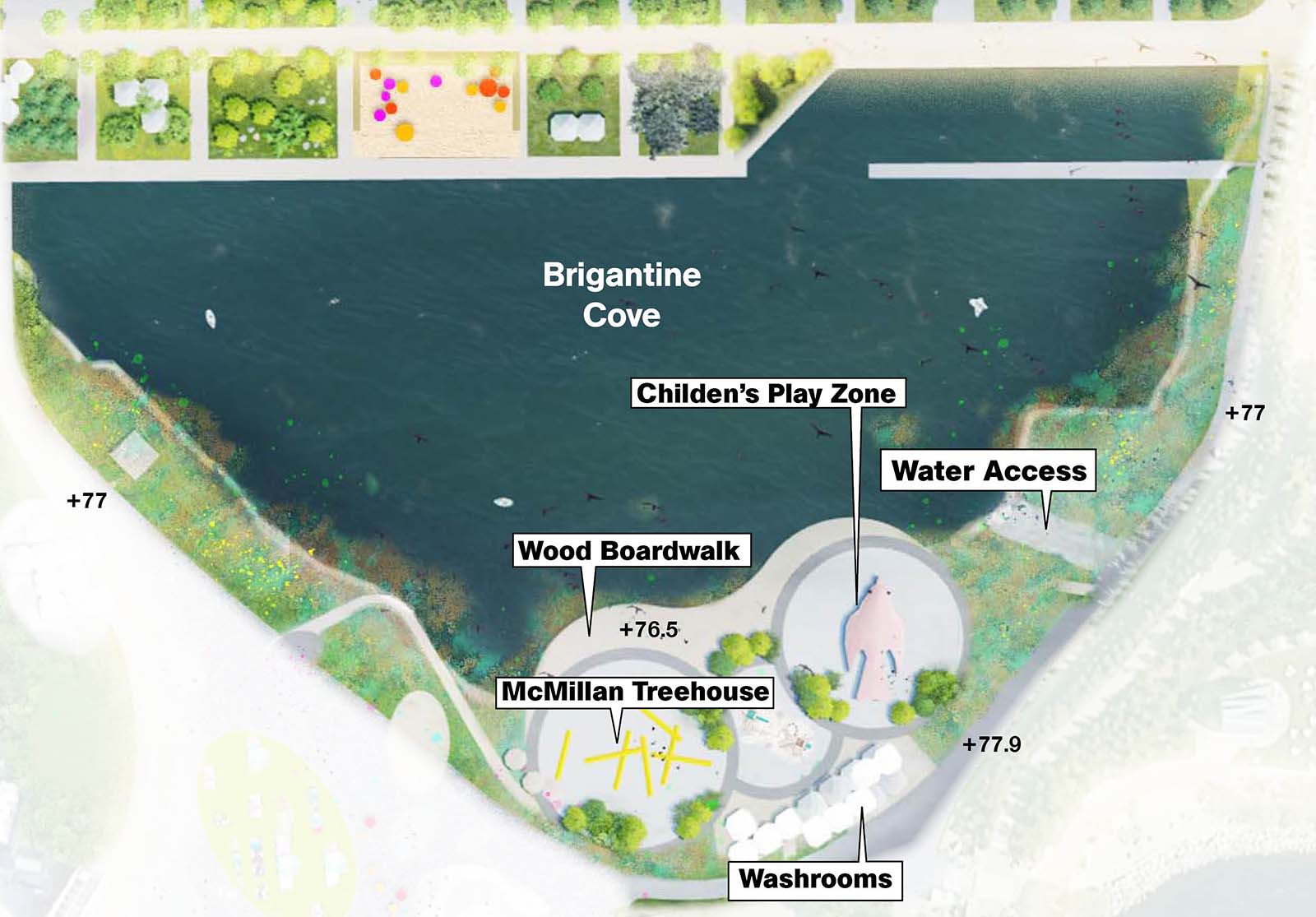
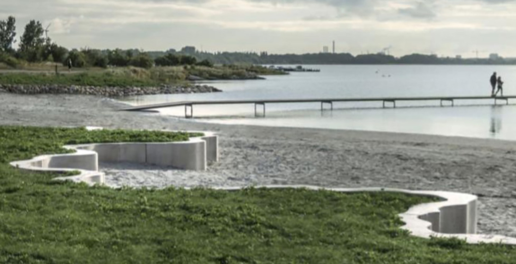
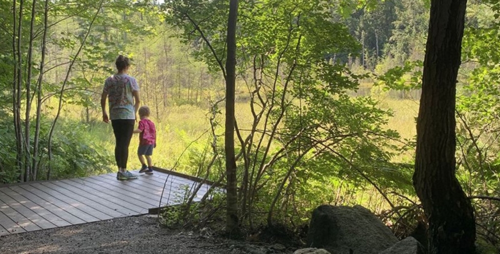
Concept B: Wetland + Nature
- Evolved Hough design, altering shape of Cove.
- Floating boardwalk system.
- Wetland creation.
- Focus on creating new opportunities for enhanced ecosystems and ecology.
- Improved water circulation and quality.
Feedback/comments
This section is now closed.
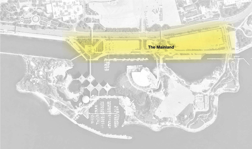
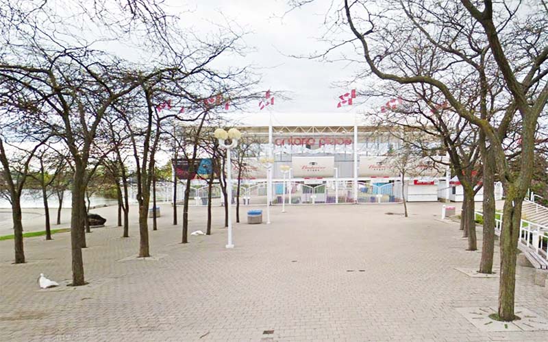
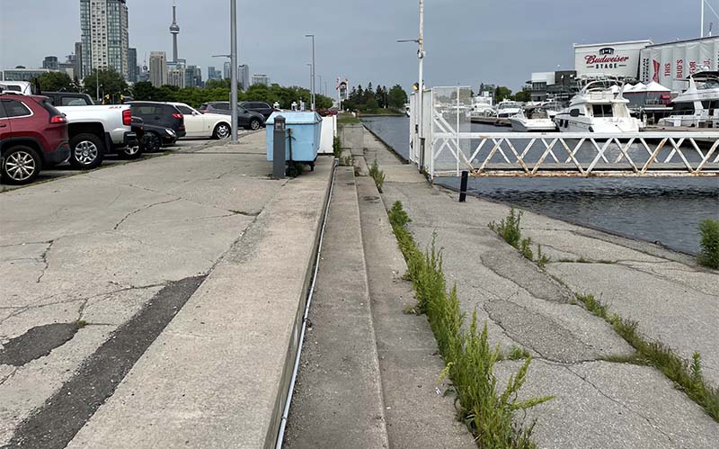
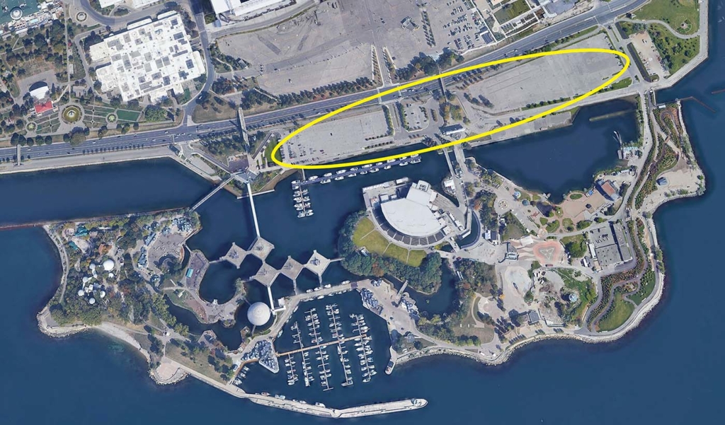
Zone 4: The mainland
Design considerations
Issues
- Expansive parking and asphalt area.
- Aging infrastructure.
- Under-utilized water’s edge.
- Poor waters’ edge experience.
- Limited greenery.
Opportunities
- Consolidation of roads and parking areas
- Waters’ edge promenade.
- Reduced paving and increase surface permeability.
- Flood and storm protection, stormwater management.
- Martin Goodman trail connections.
- May be subject to modification in the future.
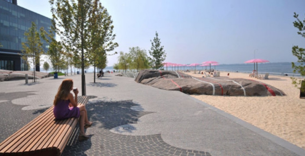
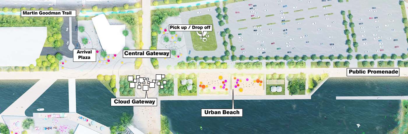
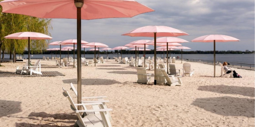
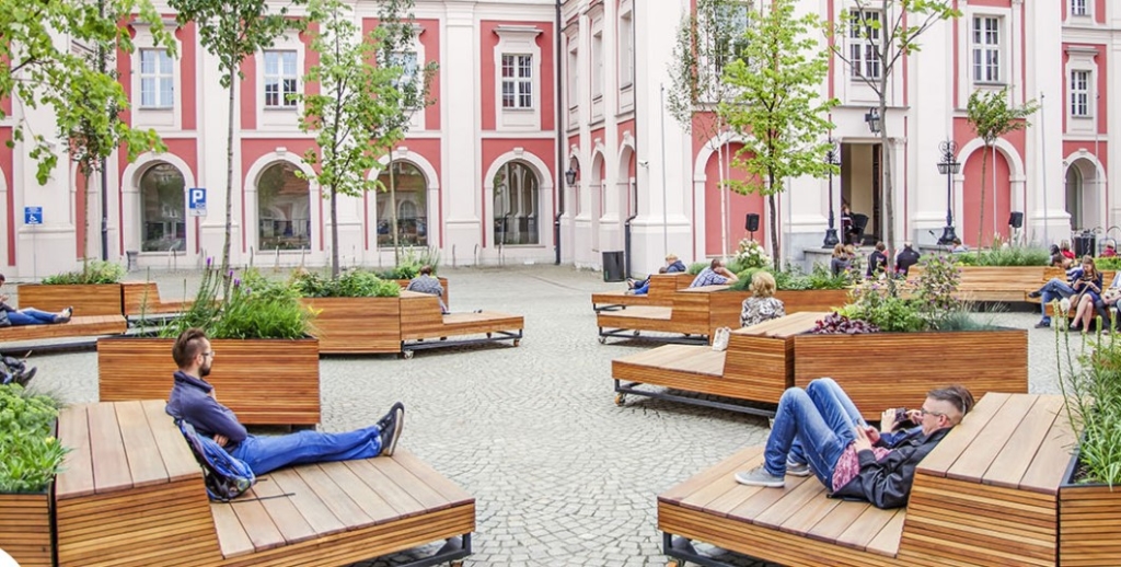
Concept A: Urban and Active
- Active and diverse experiences.
- Hard and soft landscape, including plazas and an urban beach.
- Waters’ edge promenade.
- Dedicated pick up and drop off.
Concept B: Green gateway
- Focus on passive recreation uses and less active zones.
- More green character with extensive planting and minimal hardscape.
- Sheltered, enclosed public spaces.
- Extends ‘park feel’ onto mainland.
- Dedicated pick up and dropp off area.
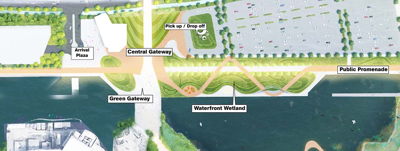
The mainland parking
Within the Mainland focus zone, there are three potential solutions for parking: surface parking (existing), above ground parking, and underground parking. Any mainland parking solution considered should meet the following project objectives:
- Not limit or negatively impact new public spaces on site.
- Protect for heritage views of Pods and Cinesphere from Lakeshore Blvd.
- Meet municipal policies for waterfront development.
- Allow for increased provision of parking to meet demand.
Feedback/comments
This section is now closed.
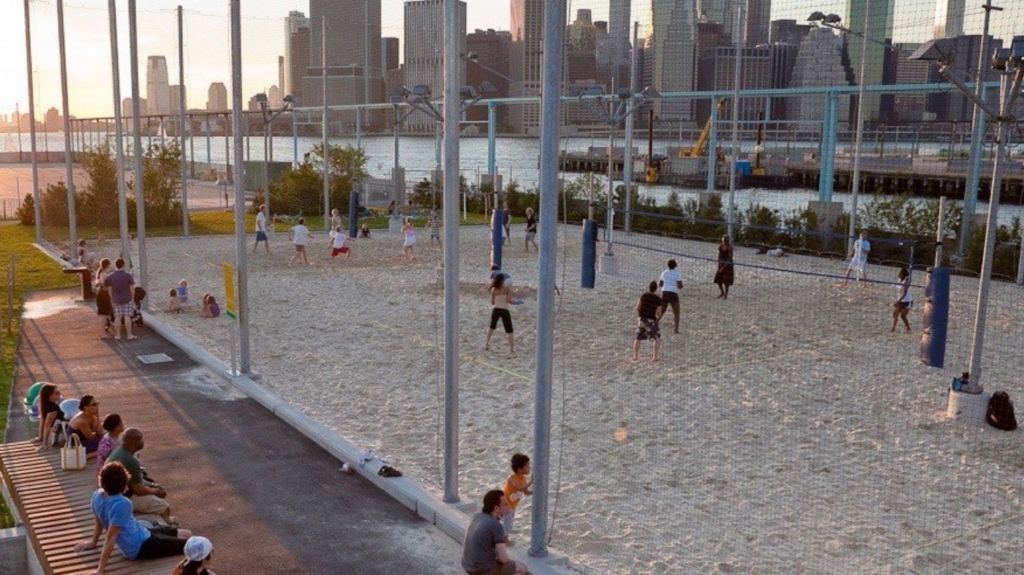
Zone 5: The forum
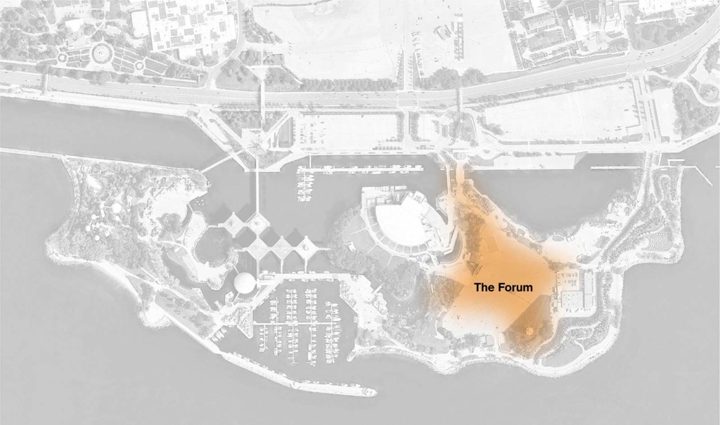
Design considerations
Issues
- Poor quality landscape (asphalt)
- High degree of run-off, flooding, and storm water management issues.
- Requires adequate space for large scale events and celebration.
Opportunities
- Provide open, flexible gathering space for outdoor events.
- Connections from the mainland to the southern waterfront.
- Restore existing and add new public washrooms.
- May be subject to modifications in future.
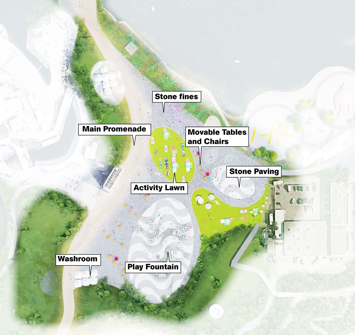
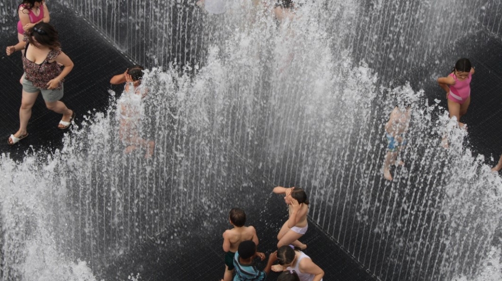
Concept A: Fountain + flexible space
- Highly flexible space able to accommodate wide range of programming and users.
- Mix of soft and hard landscape.
- Offers high-level of accessibility.
- Moveable furniture creates outdoor rooms and spaces.
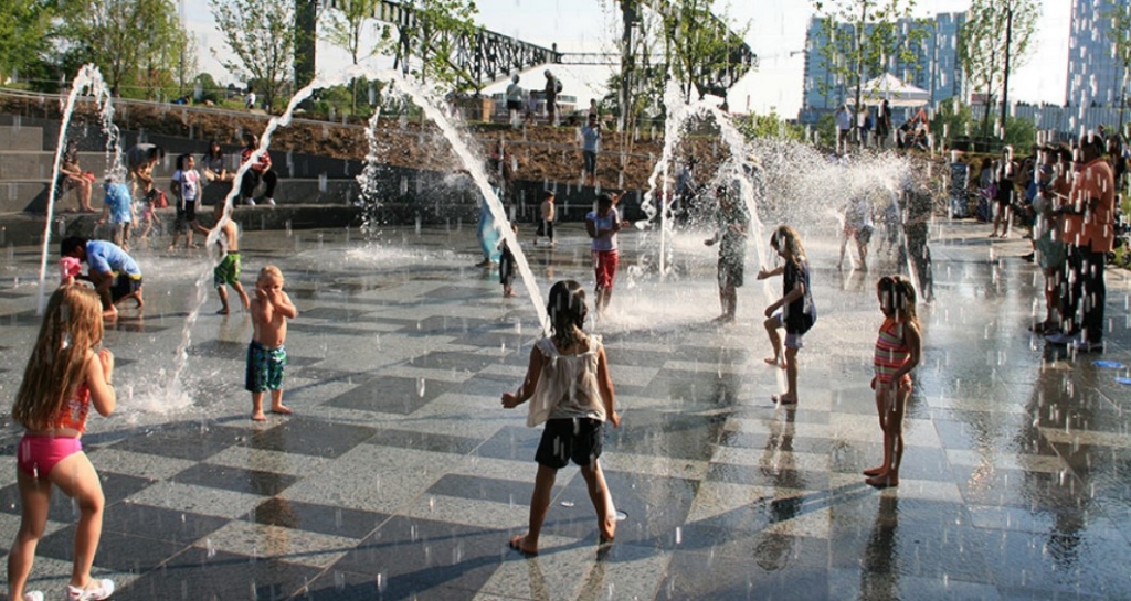
- Central fountain becomes all-season destination (for example, ice rink in winter).
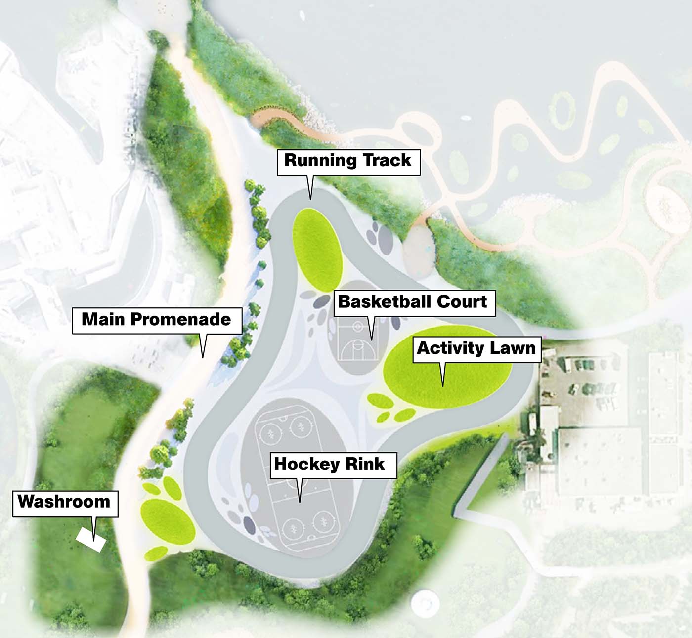
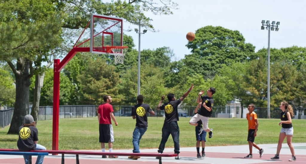
Concept B: Sports + recreation hub
- Defined space with specific sports activities contemplated.
- Primarily hard landscaped.
- Structures would be required for amenities such as change rooms, washrooms and Opportunity for an ice track in winter months.
Feedback/comments
This section is now closed.